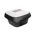
The Leica GS18 is a self-learning GNSS smart antenna. GS18 inherits all features of the Leica GS18 T except tilt compensation. However, the GS18 grows with your business: upgrade it to a tilt compensating system at any time.
The GS18 is an excellent companion to a surveyor that primarily works with a network RTK such as HxGN SmartNet. Like most of the Leica Geosystems GNSS smart antennas, the GS18 works as a rover and a base.
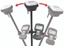
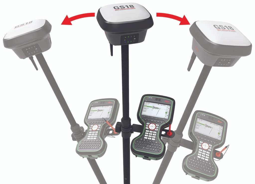
TILT COMPENSATION UPGRADE
Whenever you need the efficiency and safety improvements gained from tilted measurements, upgrade your GS18 to a tilt compensating rover. Any Leica Geosystems service can do the upgrade at any time.
ENGAGING SOFTWARE
The Leica Captivate field software is the perfect companion for the GS18. With easy-to-use apps, all measured and design data can be viewed and used, providing you with a clear understanding of your data in 2D and 3D view. Captivate spans industries and applications with little more than a simple tap, regardless of whether you work with GNSS, total stations or both.
IMPROVED PERFORMANCE
Multipath reduction and interference mitigation options in Captivate boost GNSS signal tracking quality under harsh environments, which improves RTK availability and accuracy. Also, an interference toolkit will enable filtering to remove in- and out-of-band distortions for even more robust GNSS signal tracking.
4G LTE & EXCELLENT MEASUREMENT QUALITY
Tracking multi-frequency signals comes as a standard to all Leica Geosystems GS sensors. Combined with an excellent GNSS antenna element and a position update rate of 20 Hz, the GS18 ensures reliable measurement quality.
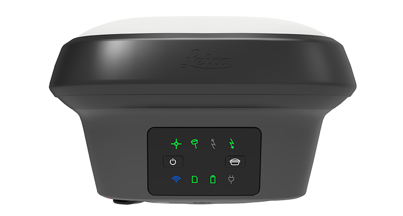
INTERNAL MEMORY
Users with any GS18 model have the flexibility to log raw data into an SD card or the internal memory.
Leica GS18 T GNSS RTK Rover
The original tilt compensating GNSS RTK rover
You can forget the bubble when you use the Leica GS18 T. It is the original truly tilt compensating GNSS solution that is immune to magnetic disturbances and is calibration-free. The sensor fusion of GNSS and Inertial Measurement Unit (IMU) creates the original true tilt compensating GNSS smart antenna. For GS18, T means tilt.
As you no longer need to watch and level the bubble, you can focus on your task at hand and save time. The GS18 T works directly out of the box without any calibration procedure and like most of the Leica Geosystems GNSS Smart Antennas, you can use it as a rover and a base.
TILT COMPENSATION
Based on sensor fusion of IMU and GNSS, GS18 T’s tilt compensation is immune to magnetic disturbances and it works immediately without calibration. With the GS18 T, surveyors have the flexibility to measure points with a levelled pole and still save the tilt values of each measurement. That way you have the trust that what was measured, is correct.
Leica GS18 I GNSS RTK Rover with Visual Positioning
Measure what you see
Introducing Leica GS18 I, a versatile, survey-grade GNSS RTK rover with Visual Positioning. Designed for surveying professionals to measure points which previously could not be measured with a GNSS rover easily and accurately. Now, you can quickly capture the site in images and measure points from them, either in the field or later in the office. For GS18, I means imaging.
Sensor fusion of GNSS, IMU and a camera come together to create Visual Positioning technology, resulting in a GNSS RTK rover so powerful that it enables you to measure what you see. GS18 I has all the functionality of the Leica GS18 T: in addition to Visual Positioning, users can for example map points with either tilted or levelled pole.
- Measure points with obstructed view to the sky more efficiently and easily.
- Capture points you couldn’t reach before with a GNSS rover.
- Gain more flexibility and control, with no need to use additional time-consuming equipment.
- Map hundreds of points with survey-grade accuracy within minutes.
- Capture the scene quickly and decide later, what should be measured – even if the scene subsequently changes or disappears.
- Tap on an image to measure a point in the field or in the office.
- Quick and thorough so you catch every detail.


![[1-098120] 752292 GLS30 2m Fiberglass GPS Rover Rod](/web/image/product.product/430/image_512/%5B1-098120%5D%20%E2%80%8B752292%20GLS30%202m%20Fiberglass%20GPS%20Rover%20Rod?unique=f3f3183)
![[1-098262] 834668 GAT27 Multiband LTE Antenna - GS18/iCR70](/web/image/product.product/473/image_512/%5B1-098262%5D%20834668%20GAT27%20Multiband%20LTE%20Antenna%20-%20GS18-iCR70?unique=bd6e7e1)
![[1-098263] 849256 GAT28 UHF Antenna - GS18/iCR70](/web/image/product.product/474/image_512/%5B1-098263%5D%20849256%20GAT28%20UHF%20Antenna%20-%20GS18-iCR70?unique=8f010e8)
![[1-098277] SP60 GNSS Receiver Kit](/web/image/product.template/485/image_512/%5B1-098277%5D%20SP60%20GNSS%20Receiver%20Kit?unique=32d2dbb)
![[1-098277] SP60 GNSS Receiver Kit](/web/image/product.template/485/hover_image/%5B1-098277%5D%20SP60%20GNSS%20Receiver%20Kit?unique=32d2dbb)
![[1-098294] SP85 GNSS Receiver Kit](/web/image/product.template/502/image_512/%5B1-098294%5D%20SP85%20GNSS%20Receiver%20Kit?unique=32d2dbb)
![[1-098294] SP85 GNSS Receiver Kit](/web/image/product.template/502/hover_image/%5B1-098294%5D%20SP85%20GNSS%20Receiver%20Kit?unique=32d2dbb)